Seamless Data Fusion
ClearSKY delivers cloud-free satellite imagery through AI-powered cloud removal and data fusion — ideal for monitoring in agriculture and forestry.
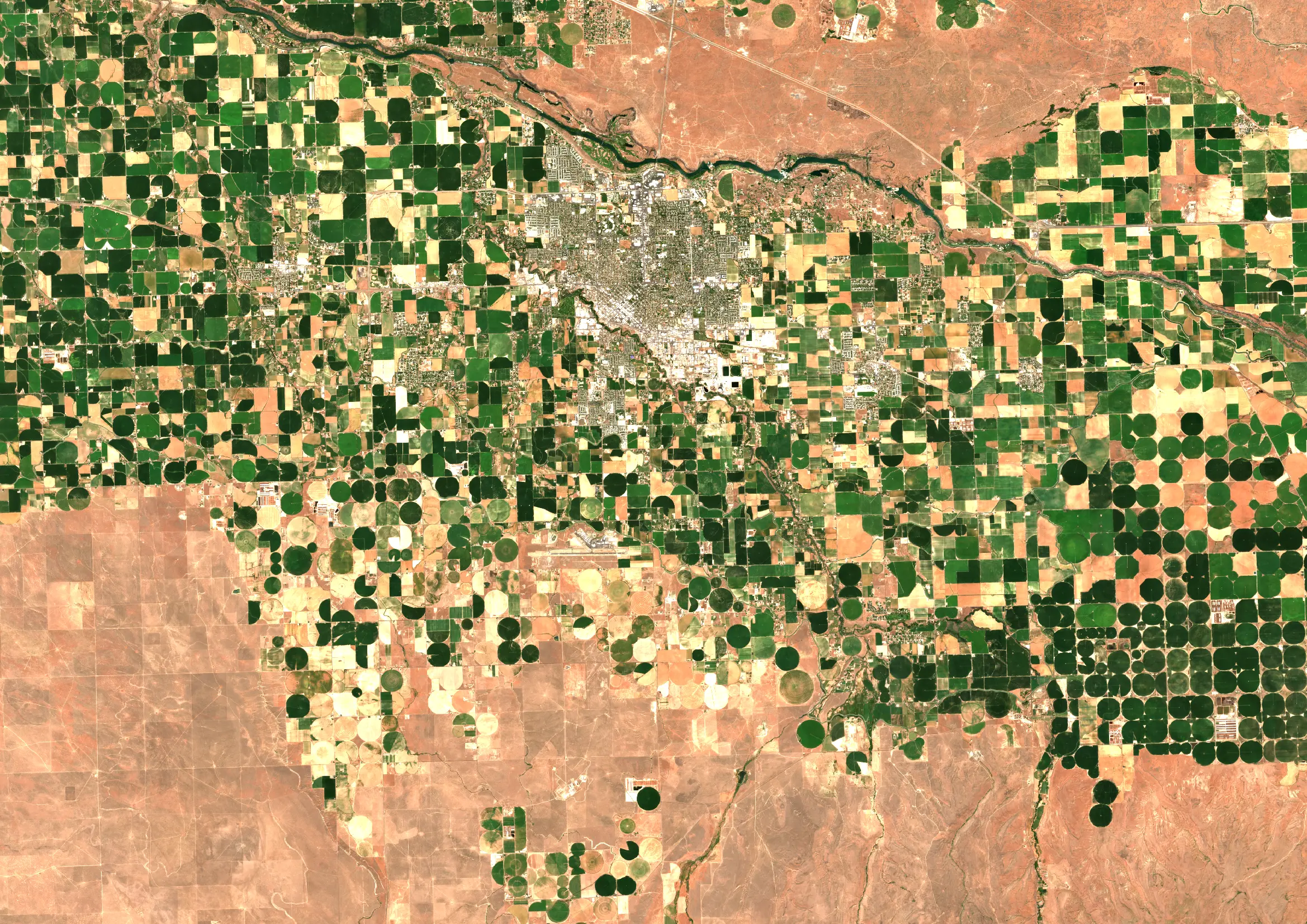
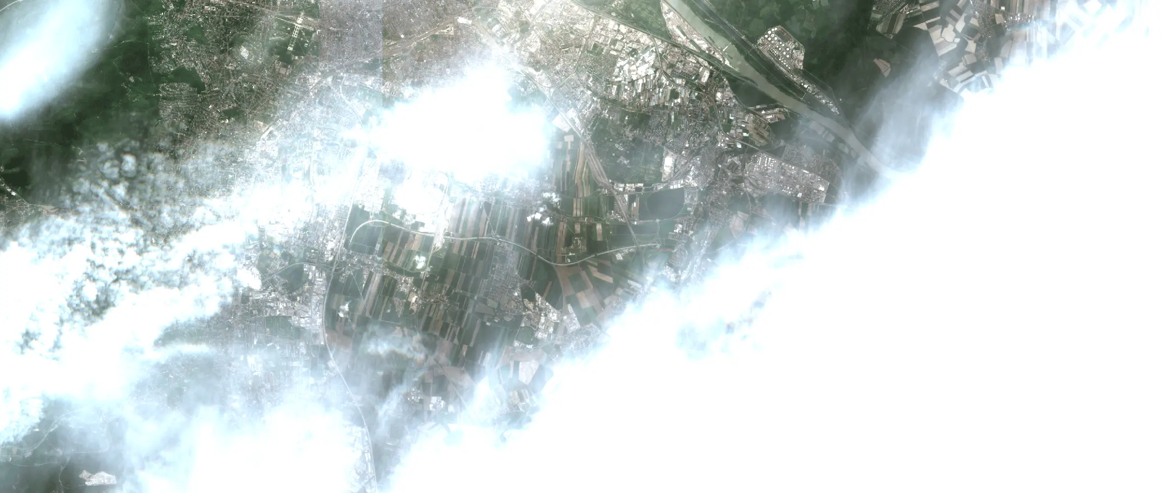
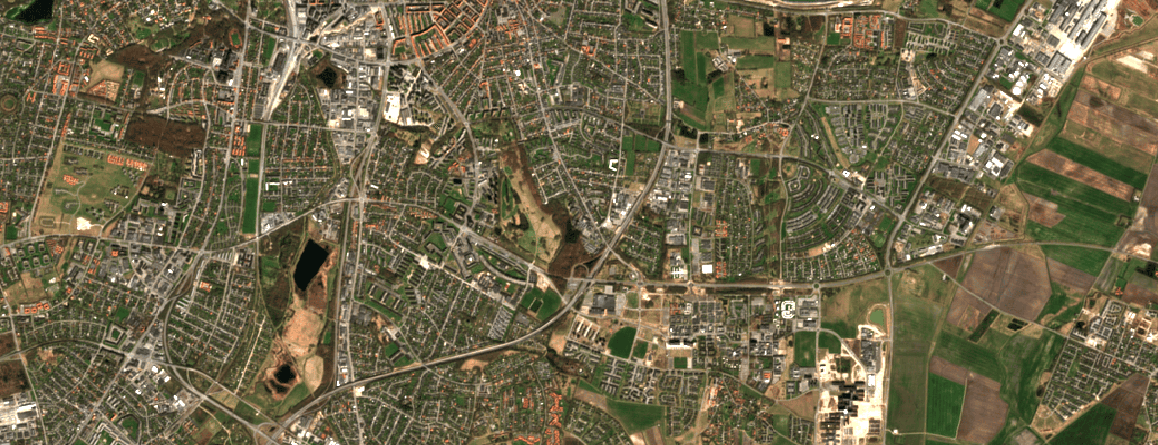
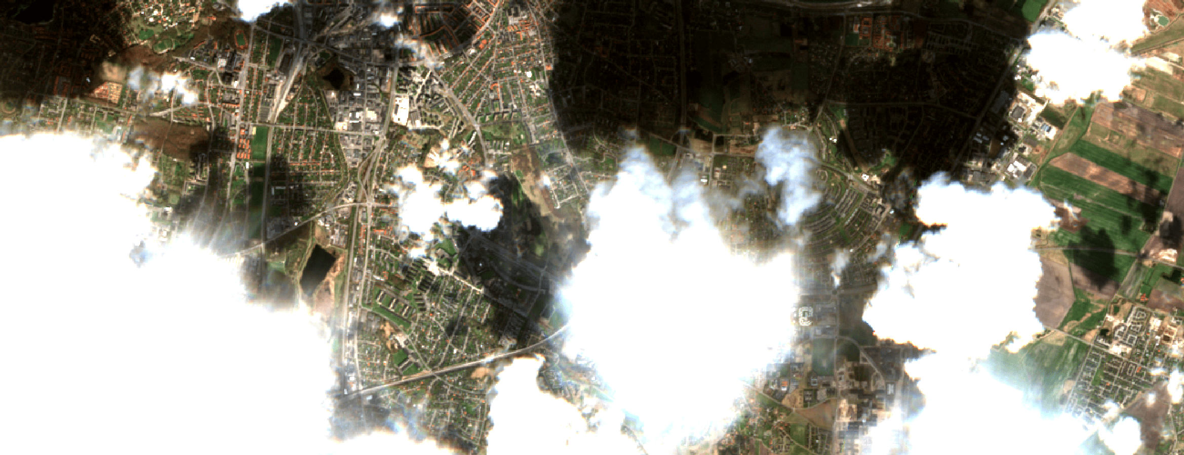
Cloud-Free Sentinel-2
ClearSKY delivers cloud-free Sentinel-2 imagery through AI-powered cloud removal and data fusion.
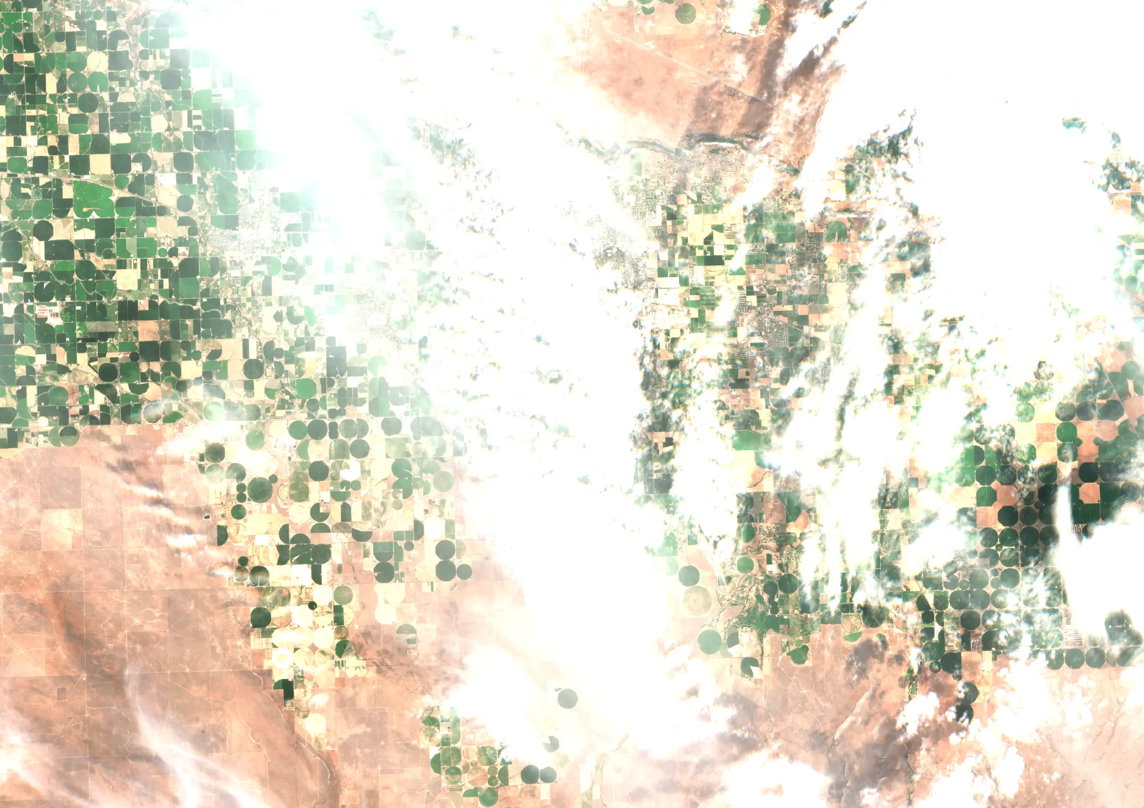
Optical & SAR AI Fusion
Our AI combines optical and radar (SAR) imagery to reconstruct missing Sentinel-2 data, preserving spectral integrity and enabling 100% analysis-ready, cloud-free images.
Near Real-Time Delivery
Order on-demand fused imagery with no interpolation. Get high-quality, cloud-free Sentinel-2 data processed in near real-time for seamless analysis and decision-making.
Seamless Workflow
Order tiles or custom bounding boxes to fit your exact needs, down to 1 km². Skip manual cloud masking and post-processing, and get analysis-ready data instantly.
Continuous Monitoring
Access flexible revisit speeds from daily to weekly. Our cloud-free imagery is excellent for tracking NDVI, deforestation, land cover changes, and other environmental metrics.
Data Fusion as a Service
Unlock the full potential of satellite data with AI-powered fusion. Our technology seamlessly integrates multi-sensor sources (optical and SAR) to generate cloud-free and analysis-ready imagery. Increase temporal reliability, improve consistency across datasets, and gain uninterrupted insights for monitoring and change detection.
Predictable pricing
Transparent €/km² with real examples. Use the calculator to price your AOI and cadence.
Per-km² pricing.
Full tiles from €0.01/km² — 90% discount on complete 2,621 km² tiles.
Min. order: 1 km². Full tile: complete 2,621 km². Estimates assume ~30 days/month; taxes/VAT excluded. Actual updates depend on input data availability and order type.
Cloud-Free Sentinel-2
Get cloud-free Sentinel-2 imagery on your schedule — whether it's daily, weekly, or anything in between! No more gaps in monitoring due to cloud cover, just uninterrupted satellite insights, tailored to your specific needs.
Access ClearSKY Sample Data
Get sample datasets showcasing our cloud-free Sentinel-2 imagery. Experience the quality of our AI-processed data firsthand.
Why ClearSKY Vision?
Best-in-Class Cloud Removal
Instant, analysis-ready imagery with full spectral fidelity.
Global, On-Demand Coverage
Any tile, any time — no borders, no mosaics, flexible revisit rates.
Rapid Turnaround
Cloud-free imagery delivered on your schedule and on your terms.
Seamless API & Support
Plug-and-play API with rapid support and expert integration guides.
Enterprise-Grade SLA
Strong enterprise SLA with 99.8% uptime commitment.
Six Years of Experience
Leveraging six years of pioneering R&D in data fusion.
Trusted by Leading Organizations
Analysis-Ready Data
Avoid the hassle and jump straight into actionable insights with perfectly preprocessed, analysis-ready imagery. No more time-consuming cloud masking or calibration. Save on costly data preparation and enjoy the freedom to focus on what matters most: informed decisions.
Near Real-Time Insights
Our near real-time data fusion works across all applications. At ClearSKY Vision, we merge only current and past sensor inputs, avoiding any use of future data or model-based interpolation, so today’s imagery reflects genuine conditions and is ready for immediate analysis.
Seamless Integration
Drop ClearSKY’s cloud-free satellite imagery straight into your GIS, dashboards, or models. Whether you’re tracking crop vitality with NDVI, monitoring logging activity with BSI, or running bespoke multispectral analytics, our AI-driven pipeline delivers analysis-ready pixels that slot effortlessly into your existing workflow. Explore the API today.